
Maps have guided exploration, trade, and conquest for centuries, yet mistakes on them have profoundly influenced world history. Incorrect maps have sent explorers to phantom islands, sparked territorial disputes, and reshaped entire political landscapes. Sometimes these errors came from limited technology or misinformation, while at other times they were deliberate distortions. As noted by the Library of Congress, maps are never just scientific documents but also reflections of human ambition and imagination. These seven examples show how inaccurate cartography left lasting marks on global history, politics, and exploration.
1. The Phantom Island of California
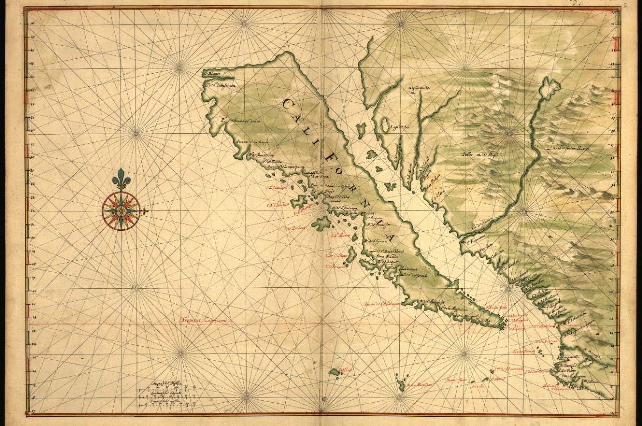
For centuries, maps incorrectly depicted California as a large island separated from mainland North America. According to the Library of Congress, this misconception began with early Spanish explorers in the sixteenth century and persisted on European maps well into the eighteenth century. The error influenced colonial ambitions, with explorers and settlers believing California was an isolated territory. This false island not only confused navigation but also shaped geopolitical strategies, delaying an accurate understanding of North American geography. The eventual correction demonstrated how persistent cartographic myths could influence real-world exploration and settlement.
2. The Myth of El Dorado’s Location
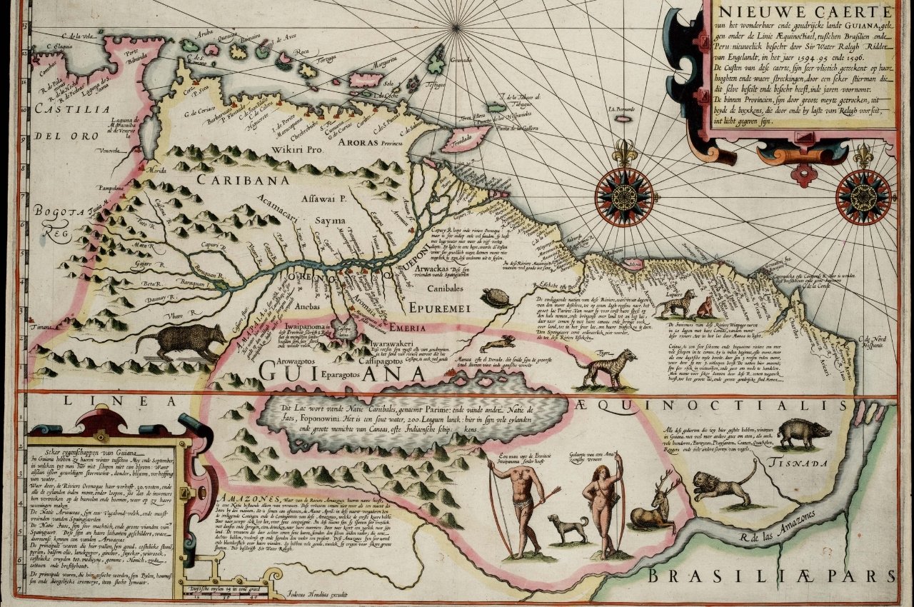
The legend of El Dorado drove explorers deep into South America, fueled by maps that placed the mythical city of gold in various regions. The Smithsonian Institution notes that these maps often place El Dorado near Lake Parime, which does not exist. Expeditions wasted years and countless lives searching for the city based on faulty cartography. The incorrect maps intensified European colonization efforts in the Amazon and Orinoco regions, leaving cultural and ecological consequences. The myth demonstrates how maps, even when wrong, could spur exploration, conquest, and exploitation across entire continents.
3. The Shifting Borders of Poland
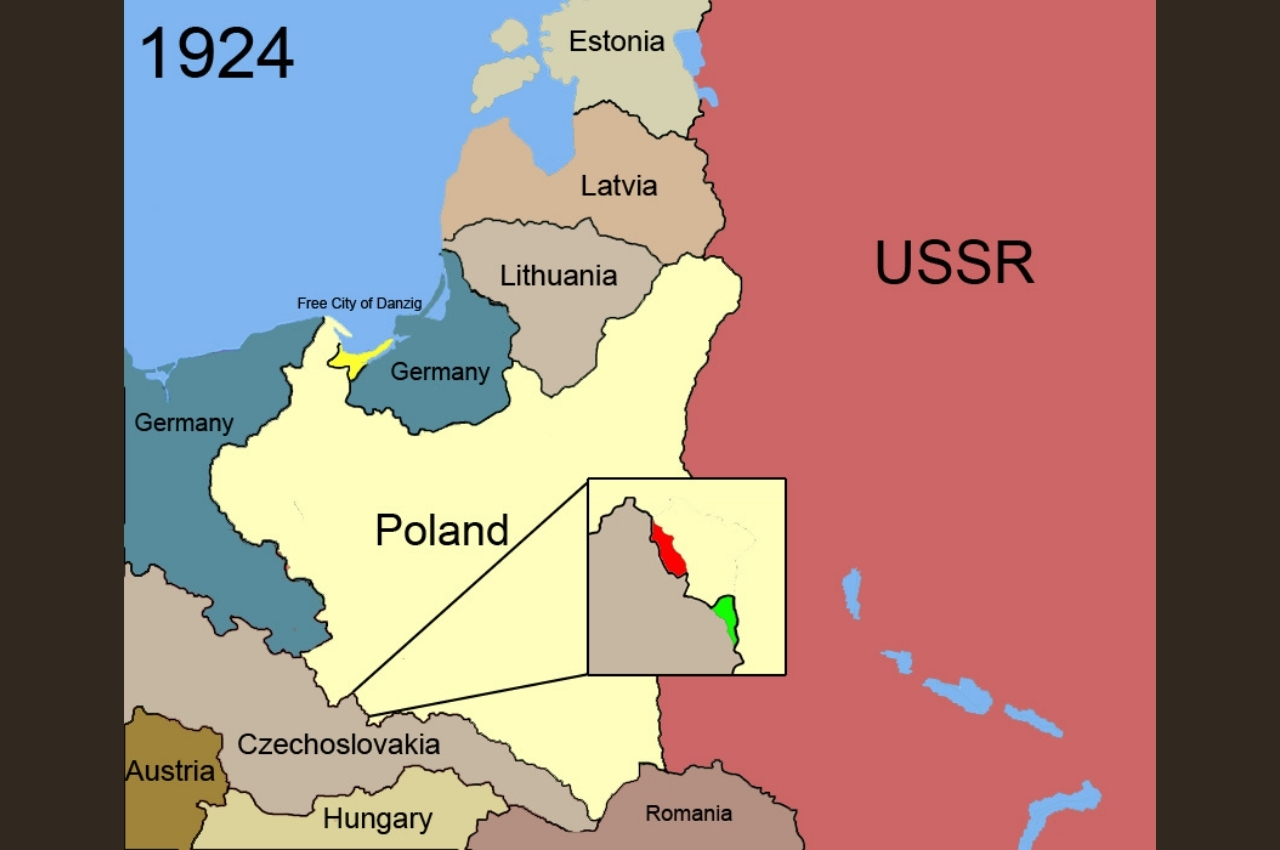
Poland’s borders have been notoriously difficult to pin down, with inaccurate maps playing a role in political manipulation. The United States Holocaust Memorial Museum highlights that throughout the seventeenth and eighteenth centuries, European powers used flawed maps to justify shifting Poland’s boundaries during partitions. These cartographic inaccuracies undermined Poland’s sovereignty and confused its territorial claims for generations. Incorrect mapping fueled imperial ambitions, helping neighboring empires carve up the nation multiple times. The manipulation of maps in Poland’s case demonstrates how errors, whether accidental or intentional, directly affected national survival and identity.
4. The Nonexistent Mountains of Kong
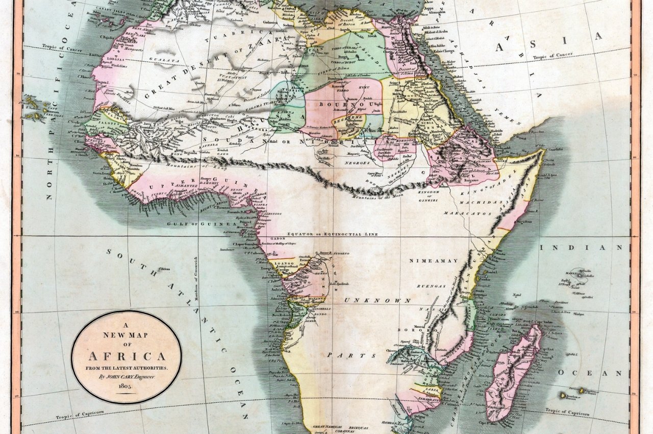
The Mountains of Kong appeared on maps of West Africa from the late eighteenth to early twentieth centuries, even though they never existed. According to the Royal Geographical Society, early explorers misinterpreted local accounts and mapped the mountains as a massive range spanning thousands of miles. The error persisted for nearly a century, influencing exploration and colonial planning. European powers used the supposed mountain range as a reference for dividing African territories. The eventual correction revealed the dangers of cartographic assumptions and highlighted how incorrect maps could shape colonial expansion and exploitation.
5. The Disputed Mapping of Kashmir
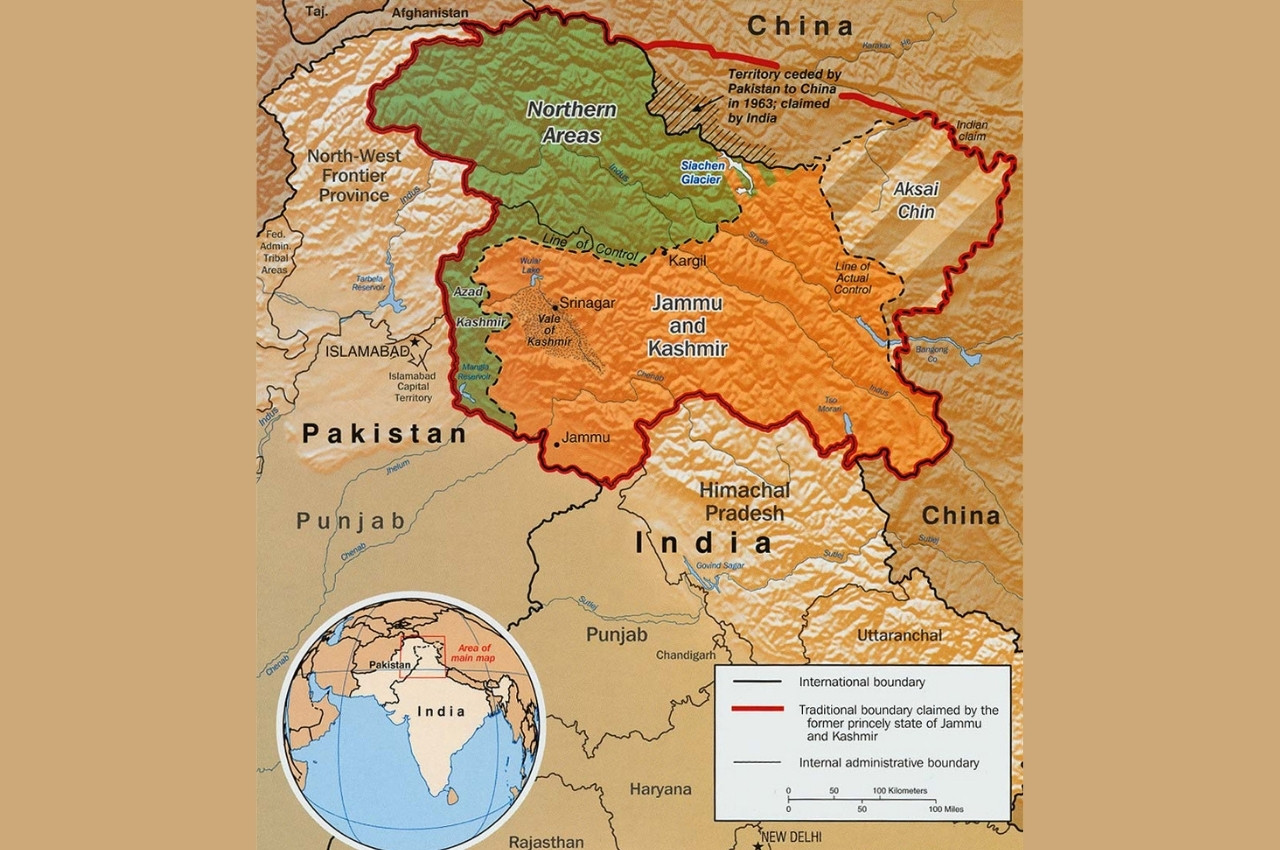
Kashmir has been a focal point of conflict between India, Pakistan, and later China, with maps playing a decisive role. The U.S. State Department notes that discrepancies in British colonial maps and later international versions fueled competing territorial claims. These cartographic ambiguities left legacies that continue to spark conflict today. Incorrect or deliberately vague boundaries created confusion about sovereignty and control. The reliance on flawed maps in such a sensitive region shows how cartography can exacerbate political disputes, shaping decades of military and diplomatic tension between powerful neighboring nations.
6. The Mississippi River’s False Path
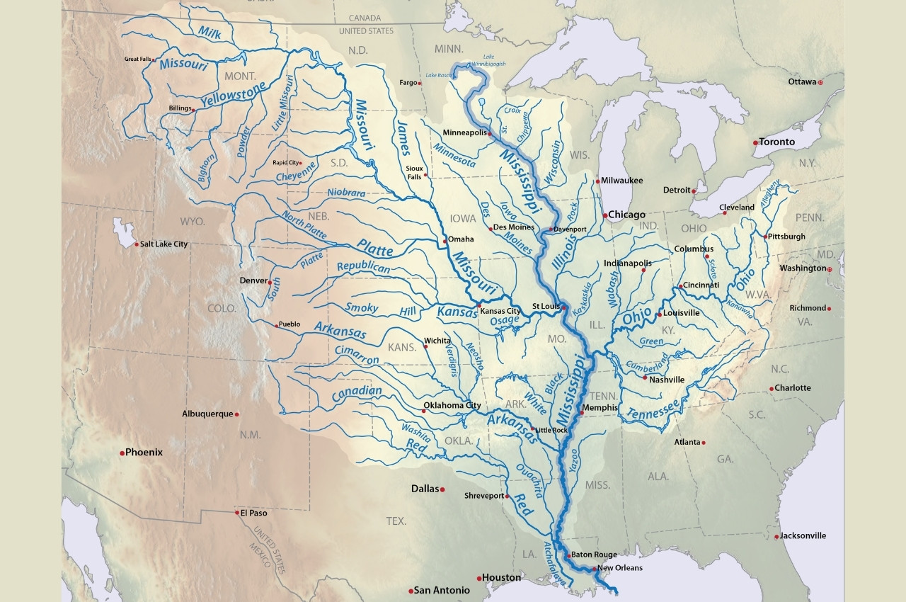
Early European maps of North America often portrayed the Mississippi River inaccurately, with some versions even suggesting it flowed into the Pacific Ocean. The National Archives explains that these errors came from limited exploration and wishful thinking about trade routes. This misconception shaped France’s and Spain’s colonial strategies, as leaders believed they could access Asia through the continent. The eventual correction proved vital in understanding North America’s true geography and river systems. This mistake highlights how faulty assumptions in cartography influenced settlement, diplomacy, and the competition for colonial control in the Americas.
7. The Misplaced Prime Meridian
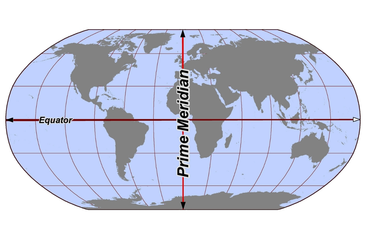
Before Greenwich, England, was adopted as the official Prime Meridian, maps often used Paris, Rome, or other locations as the zero point. According to the National Maritime Museum in Greenwich, the lack of agreement confused navigation and international trade. Ships sailing with charts based on different meridians often miscalculated distances, leading to accidents and disputes. The establishment of Greenwich as the standard in 1884 corrected the inconsistencies, but the earlier confusion showed how cartographic disagreements could disrupt global commerce and navigation on a large scale.